Lidar Drone Market Size, Share & Demand Report By Drone Type (Rotary-Wing Drones, Fixed-Wing Drones, Hybrid Drones), By Application (Mapping & Surveying, Environmental Monitoring, Infrastructure Inspection, Disaster Management), By End-Use Industry (Construction & Infrastructure, Agriculture & Forestry, Mining, Utilities, Government & Defense), By Region & Segment Forecasts, 2024–2034
USD 3950
Market Overview
The Lidar Drone Market size was valued at USD 1.48 billion in 2024 and is projected to reach USD 6.12 billion by 2033, registering a compound annual growth rate (CAGR) of 17.2% from 2025 to 2033. Lidar-equipped drones integrate laser-based remote sensing with unmanned aerial platforms to capture high-resolution 3D mapping data. These systems are increasingly used in surveying, environmental monitoring, forestry, mining, and infrastructure inspection. The market growth reflects the rising need for high-precision geospatial data across industries that require accurate terrain modeling and spatial intelligence.
A major global factor supporting the expansion of the Lidar Drone Market is the rapid digitization of geospatial infrastructure. Governments and enterprises worldwide are adopting advanced mapping technologies to support smart city planning, climate monitoring, and large-scale infrastructure projects. Lidar-enabled drones significantly reduce survey time and operational costs compared to traditional ground-based mapping techniques while delivering improved accuracy in challenging terrain conditions. Increasing demand for digital elevation models and geospatial analytics is therefore strengthening adoption across multiple sectors.
Key Highlights
- Dominant Region: North America held 38.6% market share in 2025, while Asia Pacific will grow fastest at 19.4% CAGR (2025–2033).
- Leading Subsegments: Rotary-wing drones led the type segment with 61.2% share in 2024, while hybrid drones will grow fastest at 20.1% CAGR.
- Dominant Country: The United States accounted for USD 520 million in 2024 and USD 595 million in 2025 in the Lidar Drone Market.
Market Trends
Integration of AI-Driven Data Processing
Artificial intelligence and machine learning are increasingly integrated with lidar drone systems to enhance data interpretation. Modern lidar drones can collect millions of spatial data points during a single flight mission. AI-powered processing software enables automated classification of terrain, vegetation, and infrastructure elements. This integration significantly reduces post-processing time and enables near real-time insights for industries such as construction and environmental management. As organizations seek faster analytics workflows, AI-enabled lidar drone platforms are becoming an important component of geospatial data ecosystems.
Expansion of Lidar Drones in Environmental Monitoring
Environmental monitoring applications are emerging as a notable trend in the Lidar Drone Market. Governments and research institutions are deploying lidar drones to track forest canopy density, coastal erosion, wildlife habitats, and flood risk areas. Compared with satellite-based imaging, lidar drones provide detailed ground elevation data even in densely vegetated regions. Climate research initiatives and ecological mapping programs are therefore encouraging the adoption of drone-based lidar systems. This trend is expected to expand further as sustainability projects and environmental regulations require accurate geospatial information for monitoring natural resources.
Market Drivers
Rising Demand for High-Precision Mapping
High-precision spatial data is increasingly required for infrastructure development, land surveying, and urban planning. Lidar drones can capture accurate topographic information at centimeter-level resolution, which is difficult to achieve with traditional photogrammetry methods. Surveyors, construction firms, and engineering companies are therefore integrating lidar drones into their workflow to streamline project planning. The ability to rapidly map large land areas with minimal manual intervention is supporting widespread adoption across industrial and government sectors.
Growth in Infrastructure Inspection Activities
Inspection of power lines, pipelines, railways, and bridges requires detailed terrain mapping and structural analysis. Lidar drones offer a safer and more efficient alternative to manual inspection methods. With the expansion of infrastructure networks globally, inspection activities are increasing significantly. Utility providers and transportation authorities are adopting drone-based lidar systems to monitor asset conditioone Market faces challenges related to the high cost of lidar sensors and drone platforms. Advanced lidar payloads require specialized laser scanning components, high-precision navigation systems, and complex data processing software. The overall system cost can therefore be significantly higher than standard drone imaging systems. Additionally, operating lidar drones often requires skilled technicians capable of flight planning, calibration, and data interpretation.
Maintenance expenses and software licensing costs further increase the total cost of ownership. Small surveying firms and emerging startups may find it difficult to invest in high-end lidar drone systems due to these financial barriers. As a result, market penetration in price-sensitive regions may be slower compared to developed markets.
Market Opportunities
Expansion of Smart City Mapping Projects
Urban authorities worldwide are investing in smart city infrastructure and digital urban mapping initiatives. Lidar drones provide highly accurate 3D models of buildings, transportation networks, and urban landscapes. These capabilities support city planning, traffic management, and infrastructure monitoring. As governments increase investments in smart city development, lidar drone adoption is expected to grow steadily within municipal planning departments and geospatial agencies.
Adoption in Renewable Energy Projects
Renewable energy projects such as wind farms and solar installations require accurate terrain assessment before construction. Lidar drones enable detailed elevation mapping and site analysis for large energy installations. Project developers use these datasets to evaluate land suitability, optimize turbine placement, and assess potential environmental impacts. With renewable energy capacity expanding globally, the demand for drone-based lidar surveying solutions is expected to increase significantly during the forecast period.
Segmental Analysis
By Drone Type
Rotary-Wing Drones dominated the Lidar Drone Market with 61.2% share in 2024. These drones offer vertical take-off and landing capabilities and can hover in place, making them suitable for mapping complex terrain and infrastructure structures. Their ability to operate in confined spaces and conduct detailed inspections made them widely adopted across surveying and construction applications.
Hybrid Drones will grow at the fastest CAGR of 20.1% during the forecast period. Hybrid drones combine the endurance of fixed-wing aircraft with the maneuverability of rotary drones. This design enables longer flight times while maintaining flexible take-off capabilities. Increasing demand for extended mapping missions across large geographic areas will support growth of this segment.
By Application
Mapping and Surveying accounted for the largest share of 46.7% in 2024 within the Lidar Drone Market. Lidar drones are widely used to generate digital elevation models, contour maps, and terrain analysis datasets. Surveying companies rely on these systems to accelerate data collection while maintaining high accuracy levels in land development and engineering projects.
Environmental Monitoring will expand at a CAGR of 18.8% during the forecast period. Growing awareness of ecological conservation and natural resource management will increase the use of lidar drones in forest monitoring, flood risk analysis, and habitat mapping. Government agencies and research organizations will increasingly deploy drone-based lidar systems for environmental studies.
By End-Use Industry
The Construction and Infrastructure segment held the largest market share of 39.5% in 2024. Infrastructure developers require accurate terrain data to design roads, bridges, and large construction projects. Lidar drones enable efficient site surveys and provide detailed topographic information for engineering design processes.
The Agriculture and Forestry segment will grow at a CAGR of 19.2% through 2033. Lidar drones will increasingly be used to measure vegetation height, biomass distribution, and land topography in agricultural landscapes. This capability will support precision agriculture practices and forest management initiatives.
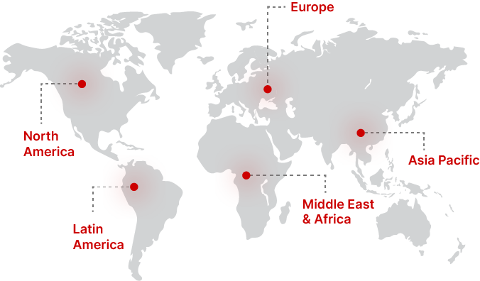
Regional Analysis
North America
North America accounted for 38.6% share of the Lidar Drone Market in 2025. The region had the largest market presence due to early adoption of drone-based surveying technologies. The market will grow at a CAGR of 16.4% from 2025 to 2033 as industries continue to deploy aerial mapping solutions across infrastructure and environmental applications.
The United States remained the dominant country in the regional market due to strong adoption of advanced surveying technologies across engineering and geospatial sectors. Large-scale infrastructure development programs and modernization of transportation networks have encouraged surveying companies to use lidar drones for project planning and monitoring. The country’s strong ecosystem of drone manufacturers and geospatial software providers further supports technological innovation and commercialization.
Europe
Europe represented 26.1% share of the Lidar Drone Market in 2025. The regional market will expand at a CAGR of 15.8% through 2033 as geospatial data collection becomes increasingly important for environmental research and infrastructure modernization.
Germany led the regional market due to its extensive industrial infrastructure and strong demand for advanced mapping technologies. Engineering firms in the country frequently use lidar drones for terrain mapping in transportation projects and urban redevelopment initiatives. Germany’s focus on digital infrastructure planning has encouraged the adoption of high-resolution aerial surveying technologies across multiple industries.
Asia Pacific
Asia Pacific held 22.8% share of the Lidar Drone Market in 2025 and will experience the fastest growth at a CAGR of 19.4% from 2025 to 2033. Rapid urbanization and infrastructure expansion across emerging economies will drive regional demand for lidar drone technologies.
China emerged as the dominant country in the region due to the rapid development of geospatial technologies and drone manufacturing capabilities. Government-supported mapping initiatives and infrastructure planning projects have created strong demand for aerial lidar systems. In addition, the presence of several drone technology manufacturers has strengthened supply chain capabilities within the region.
Middle East & Africa
The Middle East & Africa region accounted for 7.1% share of the Lidar Drone Market in 2025. The market will grow at a CAGR of 16.9% through 2033 as geospatial technologies gain importance in infrastructure and resource management projects.
The United Arab Emirates represented the dominant country in the regional market. National infrastructure development programs and large-scale urban expansion projects have encouraged the use of lidar drones for terrain mapping and construction planning. Additionally, government initiatives supporting digital transformation are promoting the adoption of drone-based mapping solutions.
Latin America
Latin America held 5.4% share of the Lidar Drone Market in 2025 and will grow at a CAGR of 15.3% during the forecast period. The region’s demand for lidar drones is supported by increasing use of geospatial technologies in agriculture and land management activities.
Brazil emerged as the leading country in the regional market. Large agricultural land areas require accurate terrain analysis and vegetation monitoring, which has encouraged the use of drone-based lidar systems. In addition, mining companies in Brazil are adopting aerial mapping technologies to improve land surveying and operational planning.
Competitive Landscape
The Lidar Drone Market features a combination of drone manufacturers, lidar sensor providers, and geospatial technology companies. Competition is shaped by innovation in lightweight lidar sensors, software integration, and autonomous flight capabilities.
DJI remains the market leader due to its strong drone manufacturing capabilities and extensive global distribution network. The company recently introduced new lidar-compatible drone platforms designed for advanced surveying and mapping applications.
Other notable players include companies focusing on lidar sensor integration and aerial mapping solutions. Firms are investing in research and development to improve sensor accuracy, reduce system weight, and enhance flight endurance. Strategic partnerships between drone manufacturers and geospatial software providers are also becoming common, enabling integrated mapping ecosystems.
Key Players
- DJI
- Trimble Inc.
- Velodyne Lidar
- Teledyne Technologies
- Phoenix LiDAR Systems
- RIEGL Laser Measurement Systems
- YellowScan
- Delair
- Quantum Systems
- Parrot SA
Recent Developments
- Several drone manufacturers introduced lightweight lidar payloads designed for extended flight endurance and improved data accuracy.
- Partnerships between drone companies and geospatial software providers expanded integrated mapping workflows for surveying firms.
- Multiple governments initiated national geospatial mapping projects utilizing lidar drones for infrastructure planning and environmental monitoring.
- Drone technology companies continued investing in AI-enabled lidar data processing platforms to reduce data interpretation time.
Lidar Drone Market Segments
Drone Type
- Rotary-Wing Drones
- Fixed-Wing Drones
- Hybrid Drones
Application
- Mapping & Surveying
- Environmental Monitoring
- Infrastructure Inspection
- Disaster Management
End-Use Industry
- Construction & Infrastructure
- Agriculture & Forestry
- Mining
- Utilities
- Government & Defense
By Region
- North America
- Europe
- APAC
- Middle East and Africa
- LATAM