Terrestrial Photogrammetry Software Market Size, Share & Demand Report By Type (Standalone Photogrammetry Software), By Deployment (On-Premise, Cloud-Based), By Application (Construction & Infrastructure, Mining & Quarrying, Archaeology & Heritage Preservation, Oil & Gas), By End Use (AEC Industry, Government & Defense, Energy & Utilities), By Region & Segment Forecasts, 2026–2034
USD 3950
Market Overview
The Terrestrial Photogrammetry Software Market Size was valued at USD 1.05 billion in 2026 and is projected to reach USD 2.45 billion by 2034, expanding at a CAGR of 11.3% during 2026–2034. The market is witnessing strong expansion due to the rising demand for high-precision 3D mapping, geospatial modeling, and digital reconstruction solutions across construction, mining, infrastructure inspection, and heritage documentation industries.
A key global factor supporting the growth of the Terrestrial Photogrammetry Software Market is the increasing adoption of digital twin technologies in infrastructure and urban planning projects. Governments and private enterprises are leveraging photogrammetry-based software to create accurate spatial representations of real-world environments, enabling better decision-making, predictive maintenance, and cost-efficient project execution. Growing integration of AI-based image processing, drone-assisted terrestrial scanning, and cloud computing platforms has further accelerated software adoption. The shift toward automation in surveying and mapping workflows is also enhancing productivity and reducing manual dependency across geospatial industries.
Key Highlights
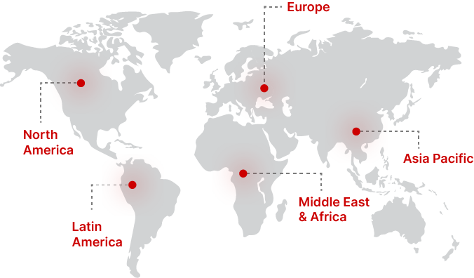
- North America held the dominant regional share of 32.0% in 2025, while Asia Pacific is projected to record the fastest CAGR of 12.8% (2026–2034).
- By Type, Standalone Photogrammetry Software dominated with 58.4% share in 2025, while Integrated GIS & Photogrammetry Suites are expected to grow at 12.5% CAGR.
- By Deployment, On-Premise solutions accounted for 54.2% share in 2025, whereas Cloud-Based platforms will expand at 13.6% CAGR.
- By Application, Construction & Infrastructure led with 36.7% share in 2025, while Archaeology & Heritage Preservation is projected to grow at 13.2% CAGR.
- By End Use, the AEC Industry held 38.1% share in 2025, while Government & Defense is expected to grow at 12.9% CAGR.
- The United States recorded market values of USD 310 million in 2024 and USD 345 million in 2025, driven by advanced geospatial digitization projects.
Market Trends
AI-Enhanced Photogrammetry Processing
The Terrestrial Photogrammetry Software Market is witnessing rapid integration of artificial intelligence and machine learning algorithms to automate image stitching, feature detection, and 3D reconstruction. AI-enabled tools significantly reduce processing time while improving spatial accuracy. This trend is particularly important in large-scale infrastructure projects where rapid modeling is required for decision-making and planning efficiency.
Cloud-Based Collaborative Mapping Platforms
The adoption of cloud-based photogrammetry platforms is increasing across engineering, construction, and government sectors. These platforms enable real-time collaboration, remote data access, and scalable storage for large geospatial datasets. The shift toward subscription-based software models is also reshaping deployment strategies across the Terrestrial Photogrammetry Software Market.
Market Drivers
Rising Demand for 3D Spatial Mapping in Infrastructure Development
Rapid urbanization and infrastructure expansion are driving the need for accurate 3D spatial mapping tools. The Terrestrial Photogrammetry Software Market benefits from increasing use in road construction, smart city projects, and transportation planning. High-resolution modeling enables engineers to analyze terrain, optimize designs, and reduce construction risks, improving project efficiency.
Increasing Adoption of Digital Twin Technology
The adoption of digital twin frameworks across construction, energy, and industrial sectors is a major growth driver. Photogrammetry software plays a critical role in creating real-world digital replicas that support monitoring, simulation, and predictive maintenance. As industries prioritize operational efficiency and asset optimization, demand for terrestrial photogrammetry solutions continues to rise.
Market Restraint
High Computational Requirements and Software Complexity
A major restraint in the Terrestrial Photogrammetry Software Market is the high computational demand required for processing large image datasets and generating accurate 3D models. Advanced software often requires powerful hardware systems and skilled operators, limiting adoption among small and medium enterprises with constrained budgets and limited technical expertise.
Market Opportunities
Expansion of Smart City and Infrastructure Digitization Projects
Governments worldwide are investing in smart city initiatives that rely heavily on geospatial intelligence and 3D mapping. The Terrestrial Photogrammetry Software Market is expected to benefit from large-scale urban digitization projects that require precise terrain modeling, asset mapping, and infrastructure monitoring capabilities.
Growth in Cultural Heritage and Archaeological Documentation
Increasing efforts to digitally preserve historical monuments, archaeological sites, and cultural assets are creating new opportunities for photogrammetry software adoption. High-precision 3D reconstruction enables researchers and conservationists to document sites with minimal physical interference, ensuring long-term preservation and accessibility.
Segmental Analysis
By Type
The Terrestrial Photogrammetry Software Market is segmented into Standalone Photogrammetry Software and Integrated GIS & Photogrammetry Suites.
Standalone Photogrammetry Software dominated with 58.4% share in 2025, driven by its widespread use in professional surveying, mapping, and construction applications. These solutions offer advanced processing capabilities for high-resolution 3D modeling.
Integrated GIS & Photogrammetry Suites are expected to grow at a CAGR of 12.5%, supported by increasing demand for unified geospatial platforms that combine mapping, analysis, and visualization functionalities within a single ecosystem.
By Deployment
The market is divided into On-Premise and Cloud-Based solutions.
On-Premise deployment held 54.2% share in 2025, primarily due to security concerns and the need for high-performance computing in large-scale projects. Organizations prefer local installations for sensitive geospatial data processing.
Cloud-Based deployment is projected to grow at a CAGR of 13.6%, driven by increasing demand for remote accessibility, scalable storage, and collaborative mapping capabilities across global teams.
By Application
Applications include Construction & Infrastructure, Mining & Quarrying, Archaeology & Heritage Preservation, Oil & Gas, and Forestry & Environmental Monitoring.
Construction & Infrastructure accounted for 36.7% share in 2025, supported by growing use in surveying, road planning, and structural modeling.
Archaeology & Heritage Preservation is expected to grow at a CAGR of 13.2%, driven by increasing efforts to digitally preserve historical sites using non-invasive imaging technologies.
By End Use
The market is segmented into AEC Industry, Government & Defense, Energy & Utilities, Academic & Research, and Others.
AEC Industry held 38.1% share in 2025, driven by increasing adoption in architecture, engineering, and construction planning workflows.
Government & Defense is projected to grow at a CAGR of 12.9%, supported by investments in national mapping systems, border monitoring, and security applications.
Regional Analysis
North America
North America accounted for 32.0% of the Terrestrial Photogrammetry Software Market share in 2025 and is projected to grow at a CAGR of 10.7% during 2026–2034. The region benefits from strong adoption of advanced geospatial technologies across construction, defense, and infrastructure monitoring sectors. Increasing investments in smart infrastructure and digital twin technologies continue to support market expansion.
The United States dominates the regional market due to its extensive use of photogrammetry in transportation planning, urban development, and defense mapping applications. Government-funded geospatial modernization programs are further strengthening demand.
Europe
Europe held 28.0% market share in 2025 and is projected to expand at a CAGR of 10.9% through 2034. The region has a strong presence of engineering firms and heritage conservation projects that rely on precise 3D modeling technologies. Increasing regulatory emphasis on infrastructure safety and environmental monitoring supports adoption.
Germany leads the regional market due to its advanced engineering ecosystem and widespread use of digital construction technologies. The country’s focus on Industry 4.0 initiatives also contributes to software adoption across industrial mapping applications.
Asia Pacific
Asia Pacific captured 25.0% of the market share in 2025 and is expected to register the fastest CAGR of 12.8% during 2026–2034. Rapid urbanization, infrastructure development, and smart city initiatives are key factors driving demand. Increasing adoption of drones and geospatial analytics platforms is also supporting growth.
China remains the dominant country due to large-scale infrastructure development projects and government-backed digital mapping initiatives. Expanding construction activities and smart transportation systems are further enhancing software adoption.
Middle East & Africa
The Middle East & Africa accounted for 7.0% market share in 2025 and is projected to grow at a CAGR of 10.4% over the forecast period. The region is witnessing rising adoption of photogrammetry solutions in oil & gas infrastructure mapping, construction projects, and urban development programs.
United Arab Emirates leads the regional market due to strong investments in smart city projects and advanced infrastructure planning initiatives. The country’s focus on digital transformation in urban development is driving software demand.
Latin America
Latin America held 8.0% market share in 2025 and is expected to expand at a CAGR of 10.6% between 2026–2034. The region is gradually increasing adoption of geospatial technologies in mining, agriculture, and infrastructure monitoring applications.
Brazil dominates the regional market due to extensive use of photogrammetry in mining exploration and environmental monitoring projects. Growing infrastructure investments are further supporting software adoption.
Competitive Landscape
The Terrestrial Photogrammetry Software Market is moderately consolidated, with companies focusing on AI integration, cloud deployment, and high-precision modeling capabilities. Strategic collaborations with drone manufacturers and GIS providers are shaping competitive positioning.
Hexagon AB remains a leading player due to its strong geospatial software ecosystem and continuous innovation in 3D modeling tools. The company recently expanded its cloud-based photogrammetry suite to support real-time collaboration and automated spatial analysis.
Other major players are focusing on interoperability, automation, and subscription-based software models to expand their global customer base across construction, mining, and government sectors.
Key Players List
- Hexagon AB
- Bentley Systems Incorporated
- Autodesk Inc.
- Pix4D SA
- Agisoft LLC
- Trimble Inc.
- DroneDeploy Inc.
- Topcon Corporation
- Esri (Environmental Systems Research Institute)
- SimActive Inc.
- Capturing Reality (Epic Games)
- Skyline Software Systems Inc.
- Dassault Systèmes SE
- BAE Systems (Geospatial Division)
- Leica Geosystems (Hexagon)
Recent Developments
- In 2025, leading vendors introduced AI-powered photogrammetry engines capable of reducing 3D reconstruction time by improving automated feature extraction workflows.
- Cloud-based photogrammetry platforms expanded collaboration features enabling multi-user real-time editing of geospatial models.
- Strategic partnerships between software providers and drone manufacturers enhanced data capture accuracy and processing efficiency.
- Companies invested in integrating LiDAR and photogrammetry fusion capabilities to improve terrain modeling precision.
- Governments increased adoption of photogrammetry software for infrastructure monitoring and national mapping modernization programs.
Terrestrial Photogrammetry Software Market Segments
Type
- Standalone Photogrammetry Software
- Integrated GIS & Photogrammetry Suites
Deployment
- On-Premise
- Cloud-Based
Application
- Construction & Infrastructure
- Mining & Quarrying
- Archaeology & Heritage Preservation
- Oil & Gas
- Forestry & Environmental Monitoring
End Use
- AEC Industry
- Government & Defense
- Energy & Utilities
- Academic & Research
- Others
By Region
- North America
- Europe
- APAC
- Middle East and Africa
- LATAM